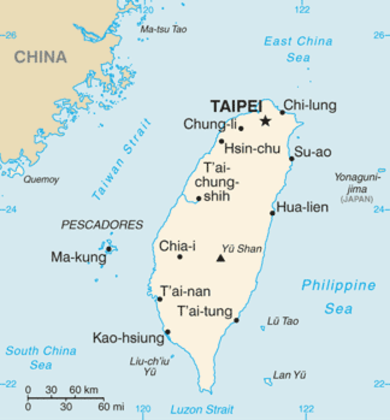
Why Think by Region Instead of “All of Taiwan” at Once?
Campervan trips are shaped by driving time, elevation, temperature, and resupply density. Thinking regionally frames “travel cost” first, then campsite comparison—reducing the risk of exhausting yourself on day one. The Ministry of Transportation and Tourism Taiwan travel portal also presents activities by area and theme, which pairs well with the regional table below.
Official Maps vs. Community Maps
Government sources (county tourism offices, national scenic area administrations) emphasize legal recreation, trails, and safety warnings. Community maps or social screenshots may update faster but may not reflect current restrictions. Because campervans are larger, confirm road and parking limits from official information before departure.
Changhua and Central Taiwan Connections
When planning coastal or mountain routes, you often pass through Changhua plains as a transfer segment. The Changhua County Tourism Information Website offers local events and attractions for “mid-route rest + resupply,” but overnight campervan stays still require legal campsites or permitted venues.
Connecting Map Thinking to JoyForest CamperVan Rental’s Service Area
JoyForest CamperVan Rental focuses on Taipei, Taoyuan, and Hsinchu—ideal for radial planning across northern Taiwan and the coast. When extending farther south or to the east coast, include return location, mileage, and driver fatigue in the plan—not just attraction count.
References & Further Reading
- Ministry of Transportation and Tourism|Taiwan.net.tw (domestic travel portal, events, and safety advisories)
- North Coast and Guanyinshan National Scenic Area Administration
- Taoyuan City Government Tourism Bureau
- Hsinchu County Tourism Website
- Miaoli County Government Culture and Tourism Bureau
- Taiwan Forest Recreation|Forestry and Nature Conservation Agency
- Freeway Bureau, Ministry of Transportation
- Highway Bureau, Ministry of Transportation (road safety and maintenance information)
- YouTube search|Freeway Bureau safety videos (cross-check with official sources)
- Wikimedia Commons (hero image is openly licensed content for thematic illustration only)
- Changhua Tourism Information Website
- Wikipedia|Taiwan (geography overview reference)
| Region | Terrain & route traits | Campervan notes | Official / guide entry | Pair with |
|---|---|---|---|---|
| Greater Taipei & Taoyuan | Urban access, dense expressways | Height limits and roadside parking | Taipei / Taoyuan tourism, Highway Bureau | North Coast scenic area |
| Hsinchu–Miaoli hills | Rolling hills, changing forest | Curves and fog | Hsinchu County tourism, Miaoli tourism | Forest recreation portal |
| Central Taiwan (Changhua area) | Plains + some mountains | Long drives can be split | Changhua tourism site, etc. | Freeway service area resupply |
| South (Yunlin–Pingtung) | Long coast, higher heat | Salt spray and sun exposure | Southern Taiwan tourism info | Coastal route articles |
| East & outlying islands | Longer legs, narrower roads | Sparser fuel and resupply | Eastern Taiwan tourism zone | Confirm rental period and mileage |
#campsiteMap #regionalTravel #TaiwanCamping #TaoyuanCamping #HsinchuCamping #MiaoliCamping #tourismBureau #campervanRoutes #JoyForest CamperVan Rental #campsitePitch